A Tumultuous Path to Preservation at Bristoe Station
The presence of a much-beloved county-run park at the Bristoe Station Battlefield is a comparatively new development. From a legacy of divisiveness and struggle, collaboration and compromise eventually emerged in the early 2000s. But by 2023, ill-considered development again threatened the integrity of those hard-fought victories.
A version of this article first appeared in the Summer 2002 issue of Hallowed Ground magazine. It is augmented with a preservation timeline outlining the far-longer campaign to preserve the battlefield.
In early 2001, it appeared that the preservation battle at Bristoe Station in Northern Virginia had finally been lost for good. Despite the enormous significance of the battle, as well as the large number of Confederate graves on the site, attempts to save the battlefield were repeatedly defeated by a combination of official neglect and landowner indifference or open hostility. However, thanks to a partnership between CWPT (a predecessor organization to the modern American Battlefield Trust) and the second-largest developer in the United States, 127 acres of this highly significant and highly threatened battlefield were saved.
The Battle of Bristoe Station, October 14, 1863, occurred when Confederate Maj. Gen. A.P. Hill – trying to cut off a portion of Maj. Gen. George Meade’s retreating Union army – thought he saw an opportunity to inflict damage to the Federals as they marched, strung out along the tracks of the Orange & Alexandria Railroad. Instead, Hill advanced into a trap. Gouverneur K. Warren’s Yankees had hidden behind the railroad embankment and their furious fire decimated Confederate ranks.
In 2001, Centex Homes approached CWPT about creating a battlefield heritage park on the 341-acre property the corporation was purchasing at Bristoe. The original proposal called for the preservation of 110 acres of Bristoe Station Battlefield, with the remaining acreage reserved for residential homes and office space. CWPT expressed interest in the plan, although the organization made it clear that the boundaries of the new park should be selected based on the historic resources of the site, not economic issues alone.
After several months of negotiations, and in consultation with historians and preservation professionals, CWPT and Centex drew up a plan for a 127-acre battlefield heritage park with boundaries based on where the majority of fighting occurred. In addition, Centex was quite amenable to altering the boundary to include the 10th Alabama cemetery and the likely location of trench graves dug immediately following the battle. According to then-CWPT President Jim Lighthizer, “For Centex to give us the entire core of the Bristoe Station Battlefield is nothing less than remarkable.”
Thanks to the willingness of Centex Homes to consider the historic resources of the battlefield, the Prince William County Board of Supervisors voted 8-to-0 to accept the Centex proposal. The board was shocked by the level of cooperation between CWPT and the developer. Board Chairman Sean T. Connaughton (R) told the Washington Post, “It is one of those rare situations involving a developer where everyone walked away satisfied.”
The preservation organization received a 127-acre donation from Centex in September 2004, and planning subsequently began for a trail network and historical markers for a park that would be owned and overseen by Prince William County. The Trust eventually transferred the land to Prince William County, and, in October 2007, the then-133-acre Bristoe Station Battlefield Heritage Park was opened to the public with a parking area and trails.
Since 2007, the Trust has acquired 216 additional acres at Bristoe Station. As of September 2023, the park contains 175 acres of preserved hallowed ground with opportunities for expansion expected in the future.
Ca. 1686 – The 30,000-acre Brent Town Tract is established
1737 – A 7,500-acre Bristow Tract is created from the Brent Town Tract
1850 – Orange & Alexandria Railroad is installed and Bristoe Station is created
August 1861 – Camp Jones is established by the Confederate Army
April 1862 – Iron Brigade is caught in a snowstorm, establishes Camp Snow
August 27, 1862 – Battle of Kettle Run
October 14, 1863 – Battle of Bristoe Station
November 1863 – Pennsylvania Reserve Corps establishes winter quarters at Bristoe Station
1909 – James Coleman, veteran of the 10th Alabama, approaches Bristoe landowner in attempt to purchase the small space encompassing the 10th Alabama Cemetery. The owner, daughter of a Union veteran, declines but promises to protect the graves as long as she lives.
1970s – Battlefield land east of Bristow Road (Rt. 619) zoned for light industry.
Winter 1988 – Prince William County briefly considers Bristow site for new debris landfill, but this is abandoned in the face of opposition from both landowners and historians/preservationists citing the presence of Civil War graves.
Autumn 1998 – County archaeologist submits a National Register nomination, but the Virginia Landmarks Register drops designation efforts due to landowner opposition
June 1990 – Because it is not listed on the National or State Registers, Bristoe is not considered among cultural resources during Prince William County comprehensive plan updates, so the “Save the Battlefield Coalition” then resubmits the nomination to the Virginia Department of Historic Resources without County support.
October 1990 – State Review Board approves Bristoe as eligible for listing on the National Register. It is placed on the state’s Historic Landmarks Register in April 1991, despite continued landowner opposition.
January 1992 – Virginia General Assembly passes SB514, to mirror the National Register in requiring the consent of a majority of landowners for inclusion on the state landmarks registry. The law is retroactive and triggers reconsideration of the Bristoe Station and Brandy Station Battlefields.
May 1993 – Virginia Department of Historic Resources removes state landmark designation for Bristoe Station. The County initiates a Comprehensive Plan Amendment for the battlefield.
October 1993 – County Planning staff report to the Planning Commission for review and approval. The Plan includes various action strategies to mitigate development impacts to cultural resources, but the Commission defers action to consider several alternatives submitted by landowner’s representative (all higher density plans).
Spring 1994 – The Prince William County Board of Supervisors approves “Alternative 7” among the strategies put forward by County Planning staff and landowner representatives. It allows the highest densities, with the option of clustered housing, and encourages easements for public access trails in areas that cannot otherwise be developed.
June 1994 – 256 acres purchased in 1988 by GLM Corp. (now bankrupt) is sold at auction for $700,000 to a partnership later reorganized as the “Broad Run L.C.”
December 1994 – County Historical Commission approaches the Broad Run L.C. seeking permission for Smithsonian forensic anthropologists to search the property for unmarked graves before development plans are firmed. Permission is never obtained.
December 1996 – County Historical Commission applies for a federal American Battlefield Protection Program (ABPP) planning grant to develop action strategies for identifying and preserving resources at Bristoe. Although awarded, the money is declined because the County lacks sufficient staff to administer the grant.
1997 – The Broad Run L.C. property is subdivided and sold to the Manassas Assembly of God (155 acres) and a “Golf Academy” (99 acres). Phase I archaeological survey reports for both properties are deemed flawed by the County Historical Commission.
1998 – Manassas Assembly of God receives rezoning approval for construction of a large church facility on 37 acres. The potential for unmarked graves on the property is brought up in rezoning hearings.
December 2000 – Centex Homes becomes the contract purchaser of the 341-acre Rollins tract on the west side of Route 619 and seeks a rezoning for its “New Bristow Village.” Phase I archaeological study acknowledges the potential for unmarked graves on the tract.
June 2001 – A thermal-imaging survey sponsored by the Sons of Confederate Veterans identifies another possible cemetery in woods. Centex negotiates preservation scenarios with the Civil War Preservation Trust, a predecessor to the American Battlefield Trust, a process detailed in Fighting the Second Civil War: A History of Battlefield Preservation.
March 2002 – The Prince William County Board of Supervisors approves Centex-requested rezoning for higher density on the non-historic portions of its property. In exchange, it proffers a 127-acre donation to the Trust, a ground-penetrating radar study in a 50’ buffer around the known cemeteries and 120 days of access for additional, independent archaeological survey. The alliance is so unusual it receives mention in The Wall Street Journal.
September 2004 – Centex transfers title of 127 acres to the Trust, although necessary construction activities (sewer/utility lines, storm water overflow) continue. Planning begins for a trail network and historical markers in a park that will ultimately be owned and managed by Prince William County.
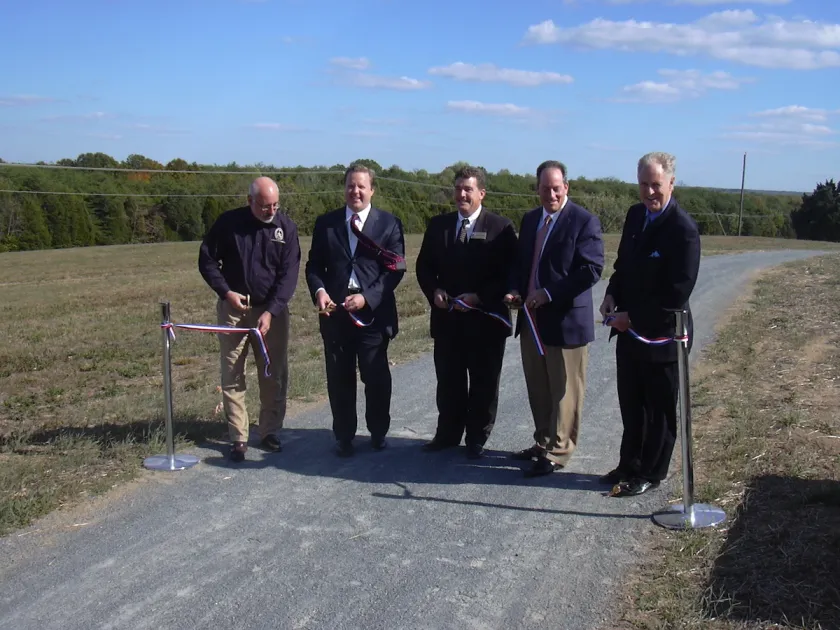
October 12, 2007 –With parking area and trails completed, the now-133-acre Bristoe Station Battlefield Heritage Park, managed by Historic Preservation Division of the Prince William County Dept. of Public Works, officially opens to the public following a dedication ceremony.
March 19, 2008 – County Planning Commission hearing to consider rezoning for “Manassas Business Park” in the southeast quadrant of the battlefield, including the position of Ricketts’ battery. County planning staff report and Historical Commission recommend denial of application due to negative impact on the battlefield.
May 6, 2008 – After the applicant addresses these concerns by proffering donation of the 42 acres with the greatest historical significance for addition to Bristoe Station Battlefield Heritage Park (expanding it to 175 total acres), the Prince William County Board of Supervisors approves rezoning for the Manassas Business Park. The amended plan was also supported by the Trust.
August 2017 – The Trust acquired the 34-acre likely site of R. Bruce Ricketts’ six-gun Union battery, just a few hundred feet behind the main battle line along the Orange & Alexandria Railroad. The transaction was made possible by a landowner donation and a federal matching grant from the ABPP.
September 2019 – The Trust acquired another 118 acres at Bristoe Station through a large-scale landowner donation, with the assistance of the federal ABPP, the Virginia Department of Historic Resources and the Virginia Battlefield Preservation Fund.
December 2021 – In the final days of 2021, the Trust saved roughly 22 acres at Bristoe Station, a victory made possible with support from the ABPP, the Commonwealth of Virginia, the Virginia Land Conservation Foundation and Prince William County. The Trust is stewarding this property until its transfer to Prince William County for incorporation into the Bristoe Station Battlefield Heritage Park.


