Saratoga National Historical Park, Stillwater, N.Y.
Studying the terrain to analyze how the action unfolded on Revolutionary War battlefields isn’t just a modern pursuit. It was the first order of business when the French Army arrived on American soil, seeking to understand the war they had just joined.
Today, the American Battlefield Trust preserves America’s hallowed battlegrounds and educates the public about what happened there and why it matters, an important mission that’s older than one might think. Exactly 240 years ago, during the Revolutionary War, America’s French allies already recognized the importance of the preservation, research and documentation of those very recent battlefields. These individuals intended, in the words of French Major General François-Jean de Chastellux (1734—88), to prepare to fight their enemy, the mighty British Royal Army, but also to inform future generations on the war they fought.
Contrary to popular belief, rather than waiting for their respective leaders to dispatch more troops and supplies, the French and American officers did not sit idle over the winter of 1780–81. Rather, the French organized a joint reconnaissance mission to previous battlefields of the American Revolution under the initiative of Chastellux, an overlooked figure who played a crucial role as a liaison officer between the French and Americans, and in the logistical and strategic planning of the allied army. My discovery of his unpublished private papers, in the ancestral château of the Chastellux family in Burgundy, reveals numerous details about his role, especially on this forgotten reconnaissance mission.
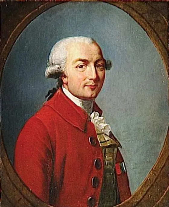
After arriving in Newport, Rhode Island, in July 1780 with the French expeditionary force of more than 5,500 men under command of the Comte de Rochambeau, Chastellux and his French brothers in arms realized that the relationship with their American allies was troubled by mutual prejudices, sharp cultural differences and the fact that less than a generation previous, they had been bitter enemies on the battlefield during the Seven Years’ War (known in North America as the French and Indian War). Furthermore, the low numbers of soldiers their respective armies had at their disposal to fight the powerful British Army disheartened both sides. The French were also disappointed by the quality of the Continental Army troops. The soldiers were “untrained, ill-disciplined,” and in contrast to their own splendid French military uniforms, American soldiers were dressed in “rags.” In addition to all of this, the French realized they had outdated maps and that many crucial details on the war they were fighting were unknown to them. This alliance seemed doomed.
However, to prevent disaster, Chastellux secured the blessing of Generals Washington and Rochambeau to send a small group of officers on a reconnaissance tour through different North American states. This “Gallo-American” team — Chastellux’s term — was sent on a joint mission to study the American theater of war to find out what could be done to get out of the allies’ desperate situation, but also to spend time together to overcome their prejudices and differences.
The use of military reconnaissance and the study of former battlefields is as old as warfare itself, but the practice of these research missions became more institutionalized and organized during the 18th century in France. Standardization in the practices of documentation had expanded greatly after the Seven Years’ War, as the French Army administration established a separate “dépôt” to preserve and collect maps and military reports based on reconnaissance missions. Additionally, officers, cartographers and engineers were trained in the “art of reconnaissance” in newly formed military colleges. The Enlightenment heavily inspired all of this: Based on the use of reason and observations, French officers collected, catalogued, systemized and organized their knowledge on the “science of war.” In America, the Continental army had also performed reconnaissance missions, but its officers were eager to cooperate with the French in their mission, not only to show them the lands, but also to learn from them on the art of reconnaissance and share their own ideas.
Starting in early November 1780, the French party left Newport, then it was onward to Massachusetts, Connecticut, New Jersey, Pennsylvania, New York and Delaware, with relevant American officers joining along the way. The French group was composed of Chastellux and his aides-de-camp, Isodore Lynch and Charles-Louis Montesquieu (grandson of the famous philosopher), and Rochambeau’s aides-de-camp Mathieu Dumas (a cartographer), Charles de Damas and Baron de Turpin (an engineer-cartographer). They met with the officers of the Continental army during their travels, amongst whom were the Marquis de Lafayette, Alexander Hamilton, John Laurens and Philip Schuyler. On two occasions, George Washington himself joined the party. A reflection of this reconnaissance expedition is today to be found in the papers of Chastellux, who kept 13 reports and drafts (today unpublished) on this reconnaissance tour in his private collection. He also included some of his observations in his travel diary, which he published in 1786.
As a typical French “soldier-philosopher” of the Military Enlightenment, Chastellux believed that “The best method for military men in following the campaigns of great generals on the ground, is not to have the different positions pointed out and explained to them: it is much better, before they are made acquainted with these details, to visit the places, to look well about on every side, and to propose to themselves little problems on the nature of the ground and on the advantages to be derived from it; then to compare their ideas with the facts, by which means they will be enabled to rectify the former, and to appreciate the latter.”
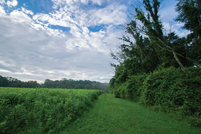
Chastellux and his research team visited West Point, Stoney Point, Princeton, Trenton, Germantown, White Marsh, Brandywine, Barren Hill, Still Water and Saratoga, all sites of battles fought within the past four years. They always visited a site with Continental army officers who had been present and brought different British and American (to have both sides) military accounts and maps with them to study while there. Once at a site, the French cartographers also made new maps. By studying the movements of the army units and the order of battles, they gained an understanding of the decisions made by generals on their tactics. In trying to understand the strategies and tactics of both armies and their ways of operating, they were also identifying mistakes and finding solutions to prevent them in the future.
After visiting the fortifications of West Point and the battlefield at Stoney Point, Chastellux visited Lafayette’s camp. The two Frenchmen were actually related, and Lafayette introduced his wife’s uncle to Washington. “A few glasses of claret and Madeira accelerated the acquaintances I had to make, and soon I felt myself at ease near the greatest and best of men,” Chastellux wrote. The two men saw each other frequently during the remainder of the war and developed a “deep friendship.”
Before visiting Trenton, Chastellux wrote: “I confess that I was rather anxious to examine the traces of General Washington in a country where every object reminded me of his successes … Colonel Moyland was telling me where one hundred and eighty English laid down their arms.” Apart from being impressed by Washington’s successes here, Chastellux paid particular attention to roads and waterways and to the events that had taken place on the exact places he visited. Indeed, the French party did extensive research on American geography, topography and roads to find potential routes, crossings, camp- or battlefield sites to determine where provisions could be bought, but also where soldiers could be recruited. A little farther down the road, Chastellux described, on the road to Philadelphia:
As you advance you find a richer and better cultivated country, with a great number of orchards and pastures, everything, in short, answers the neighborhood of a large town, and this road is not unlike those around London. Four miles from Bristol you pass the creek of Neshaminy over a ferry, it is pretty large …. It had struck me from the view of the country, and from inspecting the chart, that on the retreat of Clinton, General Washington might have passed the sources of this river and marched along it towards the Delaware. It would have covered his right flank, and by this precaution, he would have been at liberty to have approached the Delaware, and to have crossed it as soon as Clinton.
After visiting the “buzzing town” of Philadelphia, the group went to the battlefield of Germantown. There, they analyzed many details, including the specifics of the Continental army’s organization and its strengths and weaknesses. Based on the observations Chastellux had made under the guidance of John Laurens (Washington’s aide-de-camp), he wrote that the Americans had shown a remarkable will to fight, and concluded: “Perhaps this army, notwithstanding the slowness of its maneuvers and its inexperience in the war, may merit the praises of Europeans.”
Despite this will to fight, the Continental Army presented many weaknesses to Chastellux. They had made many mistakes at Germantown, and overall, Chastellux commented: “One can only be persuaded that they were devoted to destruction, and that the alliance with France alone proved the means of their preservation.”
In his personal notes on this battle, Chastellux commented on the ill-disciplined, slow-moving columns and inexperienced army, and made long remarks on how they could be improved by different column formations and better communication, training and discipline measures, something Chastellux had been thinking about for his own French Army for more than 30 years. There was hope for the American army, if a reorganization were put into place, if more soldiers were recruited and trained and especially if the Continentals worked together with enough French troops and the French fleet.
In addition, during his research Chastellux found another reason for hope for the French collaboration with the Continental Army: its general, George Washington. This can be illustrated by his visit to Pennsylvania’s Whitemarsh Battlefield with the Marquis de Lafayette. “It was a bold position which the English never dared to attack. … The position is excellent … the more respectable this position was, the more honor it did to Gen. Washington, who had divined, rather than discovered it. This was really an eagle eye’s view, for it seems he must have hovered above the trees to examine the ground concealed by them.” These kinds of positive remarks on Washington are abundant in Chastellux’s papers, as well as those of his colleagues. They show an evolution in the French mind on the capabilities of the general of the Continental army, which strengthened their hopes on the alley’s potential, and especially for their future campaign.
After Germantown, the “Gallo-American” group continued to the battlefield of Barren Hill, Pennsylvania — today known as “Lafayette Hill.” The eponymous general led the tour, and Chastellux wrote a detailed description of the general’s actions there, based on his and other testimonies. He wrote: “I followed the exact road of the left column, which leads to Schuylkill Falls, where there is a sort of scattered village, composed of several beautiful country houses.” He was not left untouched by the “pleasing landscape that would not escape the pencil of Robert and le Prince.” This passage shows the research methods employed: The French officers talked to participants first, and then formed their own ideas and analysis on the ground.
During the time of travel, a severe winter had set in, as Chastellux remarked: “I turned my face towards the north, to seek after the traces of General Gates and General Burgoyne, amidst heaps of snow.” He was eager to visit the famous site of Saratoga, New York. The French group did this with Colonel Alexander Hamilton and Brigadier-Colonel James Clinton. Before leaving, they stayed at General Philip Schuyler’s house in Albany to discuss the “Northern campaigns.” Chastellux commented: “Mr. Schuyler, to give the best answer to our questions, proposed to us to read his political and military correspondence with General Washington, which we accepted with great pleasure. The General opening his pocketbook, the Vicomte de Noailles and I divided the different manuscripts containing upwards of sixty pages of close writing.”
A few reports and correspondences detailed the “dangerous and ineffective campaign on Canada,” in the words of Chastellux; others covered past battles. Chastellux and the others read military reports the whole day, and only had “supper at ten.” This studious day shows that researching war was not only about going to the ground, but was additionally based on reading different accounts of battles and reports of military planning. Chastellux had copies made of these correspondences and kept them in his private papers, which are today kept in the Château de Chastellux.
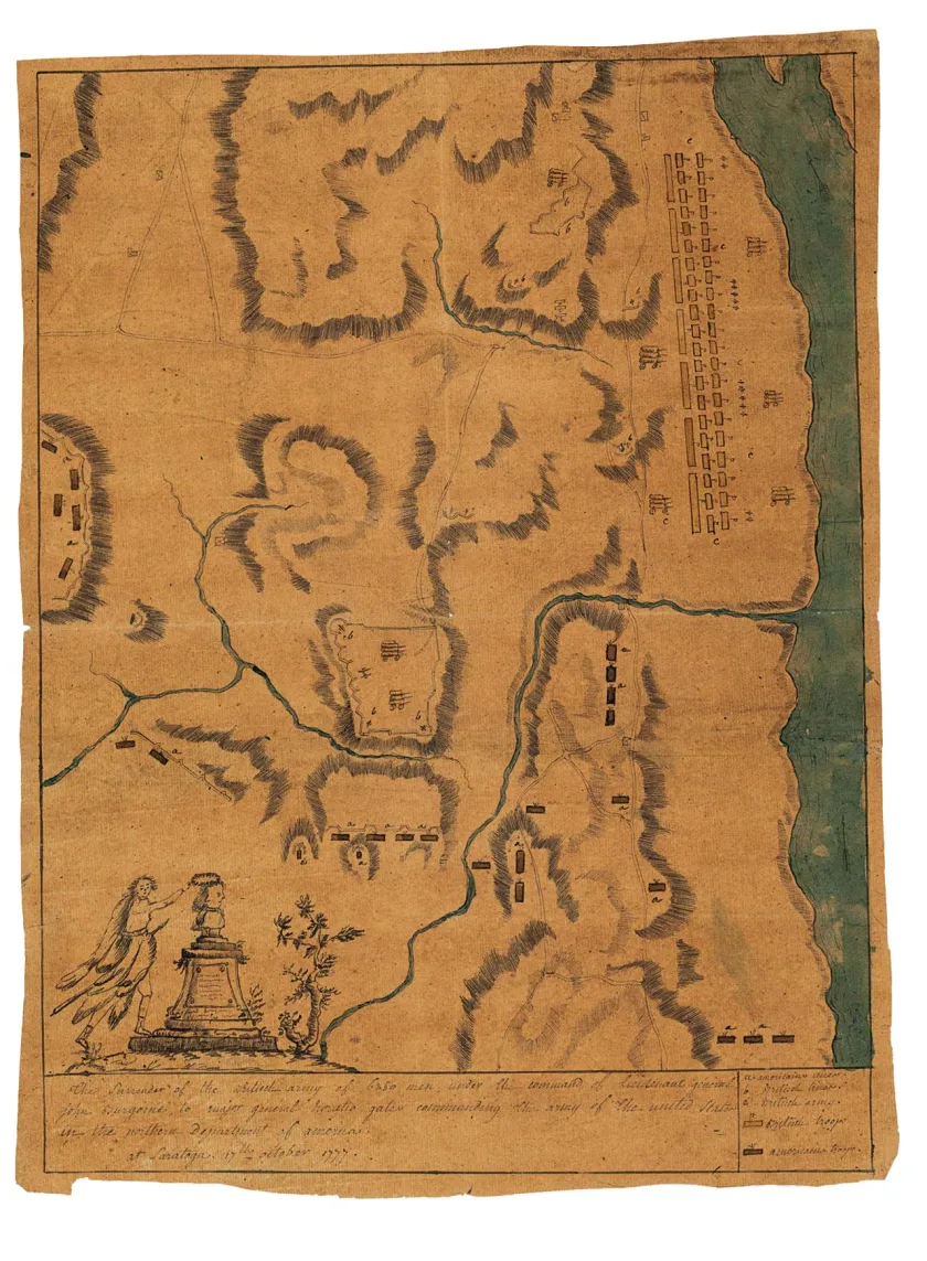
After staying with Schuyler’s team, the French continued with their research on the ground, this time at the famous battlefield site of Saratoga, where, Chastellux wrote, “I continued reconnoitering here till night, sometimes walking in the snow, where I sunk to the knees, and sometimes travelling still less successfully in a sledge … After surveying [British General John] Burgoyne’s lines, I at length got down to the high road, passing through a field where he had established his hospital.” He asked his mapmakers to draw accurate maps of the battlefield, including the positions of the armies. Escaping the snows and returning south, the French team continued to Brandywine, Pennsylvania, noting that they passed “the road where M. de Lafayette wounded as he was, stopped the fugitives, and made the first dispositions for rallying them behind the creek.” Lafayette and his aide-de-camp, Jean-Joseph Gimat, and the Generals Anthony Wayne and John Sullivan now accompanied the French travelers, and these American gentlemen provided the French with valuable information on the past battles and the American lands.
Chastellux also had received “information from General George Washington himself,” in the form of reports or letters. He wrote: “We got on horseback at nine, provided with a map completed under the direction of General Howe, and engraved in England, but we got more information from an American major, with whom M. de Lafayette had appointed a place of meeting. This officer was present at the engagement, and his house being on the field of battle, he knew it better than anybody.”
In his account, Chastellux recollected the events prior to the battle, and described George Washington’s preparations, commenting:
“When a general has foreseen everything, when he has made the best possible dispositions and, when his activity, his judgment and his courage in the action correspond with the wisdom of his measures, has he not already triumphed in the eyes of every impartial judge? And, if by any unforeseen accidents, the laurels he has merited drop from his head, is it not the historian’s duty carefully to collect, and place them on his head again? Let us hope that posterity will perform this study better than us, and let us see how such wise dispositions were disconcerted by the mistakes of some officers, and the inexperience of the troops.”
In this passage, Chastellux not only praises Washington, he also shows that he’s thinking about future generations and how they’ll study and judge the American Revolutionary War. Furthermore, his lengthy writings on Brandywine once again provide descriptions on how the research was conducted, noting that when “there is disagreement in some particulars ... I was therefore obliged to draw my conclusions from the different narratives, and to follow none of them implicitly.”
After this long tour of the American battlefields and after visiting George Washington a second time at his headquarters close to Albany, the French travelers said goodbye to their new American friends, with whom they had developed a relationship based on mutual trust and recognition of respective strengths. The French slowly made their way back, on sleighs, to Newport, where they arrived in early January and promptly began to collect their observations in large military reports. This is reflected in Chastellux’s private papers, which hold maps, long manuscript lists, drawings, descriptions and drafts, as well as the military reports they wrote in February based on these primary sources. In these, they systematically describe the battlefields they visited: They always started with a topographical description of the battlefield, then the details of the battle were discussed, followed by a detailed analysis of successes and problems and ending with what one could learn from this information. The French did this to understand the American theater of war as well as the American army’s officers, but they also sent several of the reports to the French Army administration for preservation in the military dépôts of Louis XVI. Within that broader body, these reports demonstrate an expanding definition of intelligence gathering to include research on American language, culture, religion and customs, as well as commerce and agriculture. These additions were due to an enlightened interest in discovering and understanding the world, in addition to useful information to wage war.
Based on the conclusions of this reconnaissance trip, it is possible to observe a shift from the despair of the French troops’ first months in America, to hope for the future French-American campaign. This hope continued to evolve in the spring and summer of 1781, when Chastellux was secretly sent on a mission to the Chesapeake Bay and Yorktown in April, and several French expeditionary units, together with Continental troops, organized a “reconnaissance in force” mission on New York in July. The results of the reconnaissance mission were crucial for the outcome of the American Revolutionary War: Based on the French research, with the precious aid of American officers, it had become clear that Washington's initial wish to attack New York was too dangerous, and that the safe alternative was Yorktown. The March to Yorktown and the following battle and siege, were a success because of the prior research and understanding of roads and waterways, sources for provisions and the potential battlefield itself.
