Gettysburg | McPherson's, Oak and Seminary Ridges | Now and Then
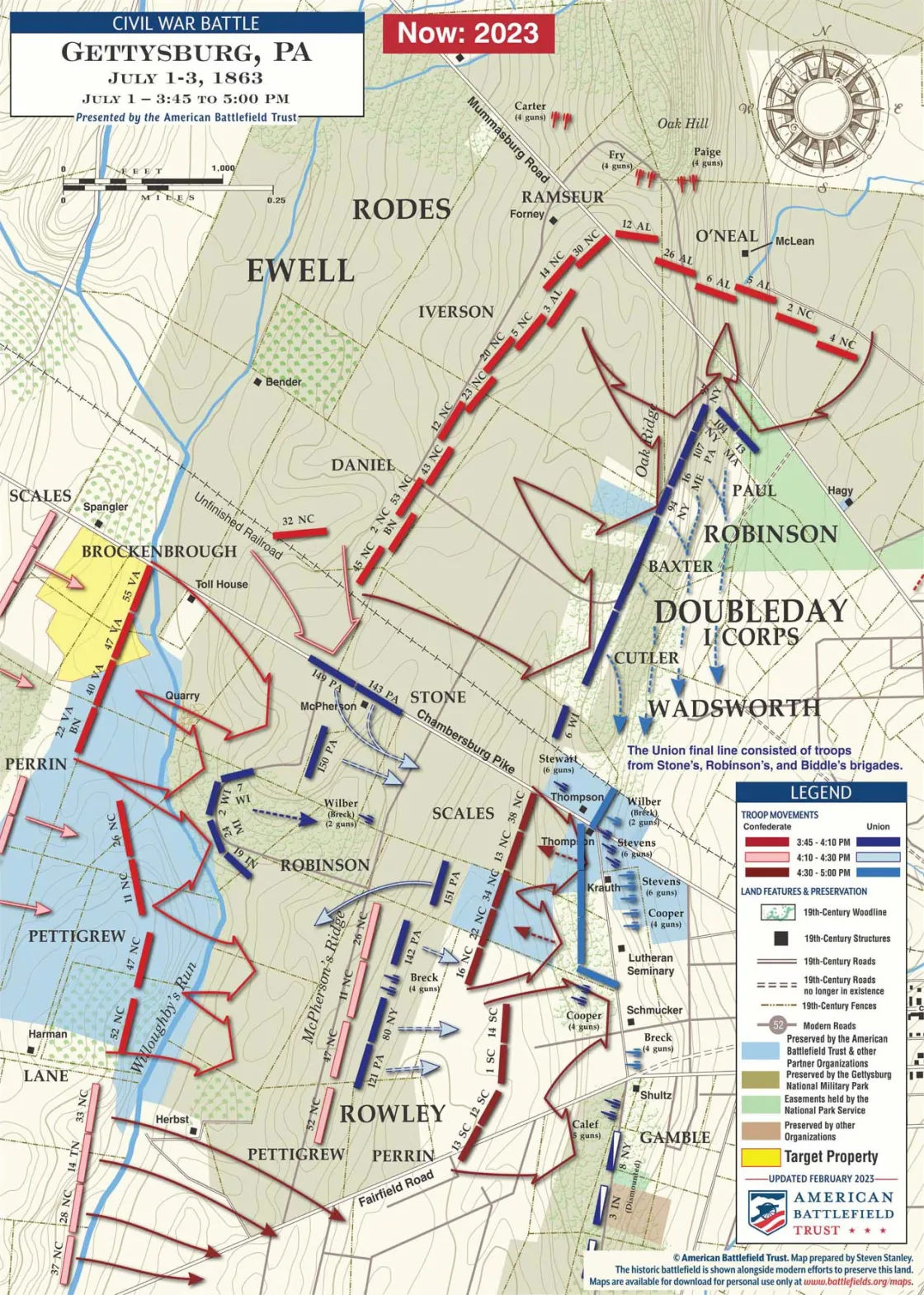
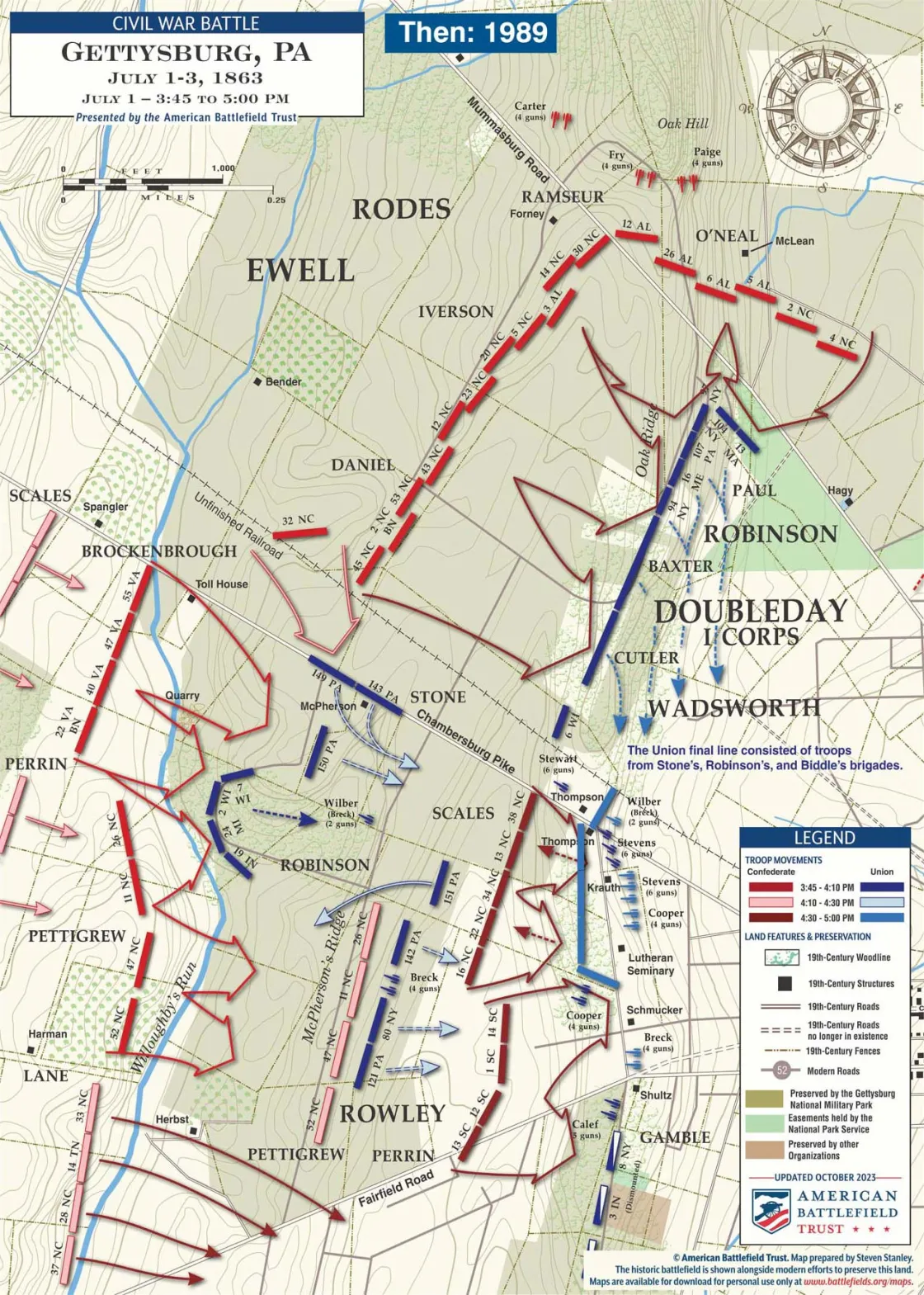
This map pairing demonstrates the impact of the Trust's preservation activities between 2011 and the present. The first map shows the current status of all preserved lands on the Gettysburg Battlefield at McPherson’s, Oak and Seminary Ridges as of April 2023. The second map shows the same land's preservation status in 2011.
The History
After slowing the Confederate advance on the morning of July 1, the Union Army of the Potomac was straining to hold off the increasing number of Confederates gathering to the west of Gettysburg. Elements of the I Corps occupied tenuous positions along McPherson’s and Oak Ridges, and had managed to hold those positions since the mid-morning. Federal reinforcements, however, were slow to arrive. The Army of Northern Virginia, by contrast was growing in strength at an almost exponential rate. Arriving from the North the divisions of generals Robert Rodes and Jubal Early threatened the Federals' exposed left. In the late afternoon, Rodes division smashed into the I Corps troops on Oak Ridge.
At the same time, Gen. Henry Heth’s division, now reinforced by troops under Gen. W. Dorsey Pender, pressed the Yankees on McPherson’s Ridge. Without reinforcements, the Union troops were compelled to fall back and reform on the crest of the ridge dominated by the Lutheran Theological Seminary.
We're on the verge of a moment that will define the future of battlefield preservation. With your help, we can save over 1,000 acres of critical Civil...
Related Battles
23,049
28,063


