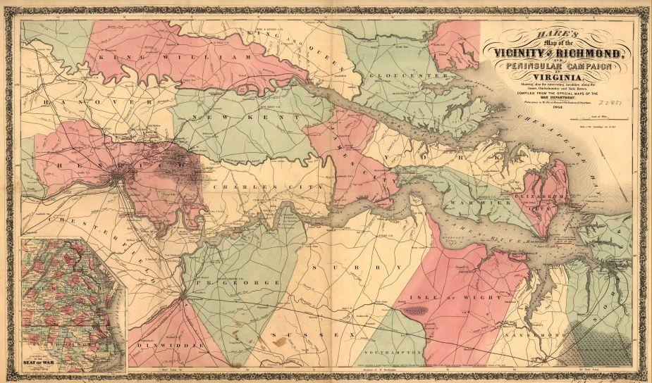
The Vicinity of Richmond, and Peninsular campaign in Virginia
Historical map of Richmond, Virginia
Hare’s Map of the Vicinity of Richmond, and Peninsular Campaign in Virginia
Showing also the interesting localities along the James, Chickahominy and York Rivers Compiled from the official maps of the War Department. New York, W. Reid Gould, 1862.
Hare, J. Knowles.
[New York, 1862]
Scale ca. 1:190,080.
Reference: LC Civil War Maps (2nd ed.), 602
Relief shown by hachures.
"Entered according to Act of Congress, in the year 1862, by J. Knowles Hare . . ." Copyright number "401 Jan. 22, 1863" is written in ink in the lower margin. "Copyright Library May 12, 1863" is stamped in the right margin.
Indicates location and dates of battles, forts, "line of Union advance" and route of "Union retreat," roads, railroads, county names and boundaries, towns, and drainage. Soundings are given for the York and James rivers.
Inset: A general map of the seat of war [eastern Virginia, Maryland, and North Carolina]. Scale ca. 1:2,800,000. 9 x 15 cm.
Description derived from published bibliography.
Library of Congress Geography and Map Division Washington, D.C. 20540-4650
Learn More: The Peninsula Campaign
Help raise the $429,500 to save nearly 210 acres of hallowed ground in Virginia. Any contribution you are able to make will be multiplied by a factor...
Related Battles
400
1,300


