The Groveton Monument, Manassas National Battlefield Park, Va.
While some of the fighting in the two battles at Manassas took place on the same ground, the two clashes mostly occurred on opposite sides of Sudley Road — the 1861 battle to the east, and the larger, second conflict in 1862 to the west. Yet, on China Ridge, Henry Hill, Sudley Road and Dogan’s Ridge, soldiers could truly say they fought on the same ground twice. Despite Second Manassas’s place as one of the bloodiest battles of the Civil War (with more than four times the casualties of the first battle), the Second Manassas Battlefield has long been relegated to a place of lesser importance in public memory. Soldiers wrote fewer words about it, visitors saw it less and early photographers all but shunned it.
Not a single photograph was taken in the area during the war, and only one known photograph was taken just after. Even as photographers finally ventured out to the Second Manassas Battlefield in the 1880s and 1890s, their coverage could hardly be called comprehensive. Most of the few 19th-century photos of Second Manassas show the Deep Cut, the area around the crossroads at Groveton or some of the ground in between. Only decades later did photographers open their shutters at places such as the Brawner Farm and Stuart’s Hill.
Groveton Monument, by William Morris Smith for Alexander Gardner, June 11, 1865
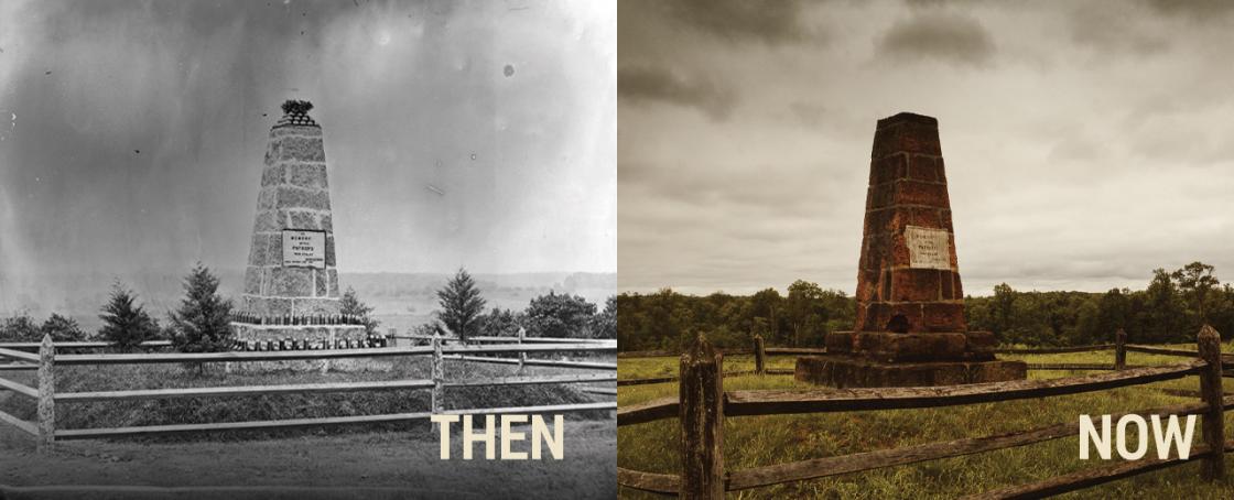
The register of Alexander Gardner’s negatives lists three photographs taken of the Groveton Monument, but I have thus far been able to confirm only one. Pictures of the Henry Hill Monument are often listed as the Groveton Monument, but the telltale stacked cannonballs atop the monument (versus an artillery shell atop the Henry Hill Monument) illustrate which is which. Artillery projectiles, still lying plentifully near the Deep Cut in 1865, were placed on the memorial for the dedication — on the same day as the ceremony on Henry Hill. This is the only known 1860s photograph taken on the Second Manassas Battlefield. Beyond the monument, we see the generally open ground between the unfinished railroad and the Warrenton Turnpike.
The Groveton Monument by HE Churchill, 1940
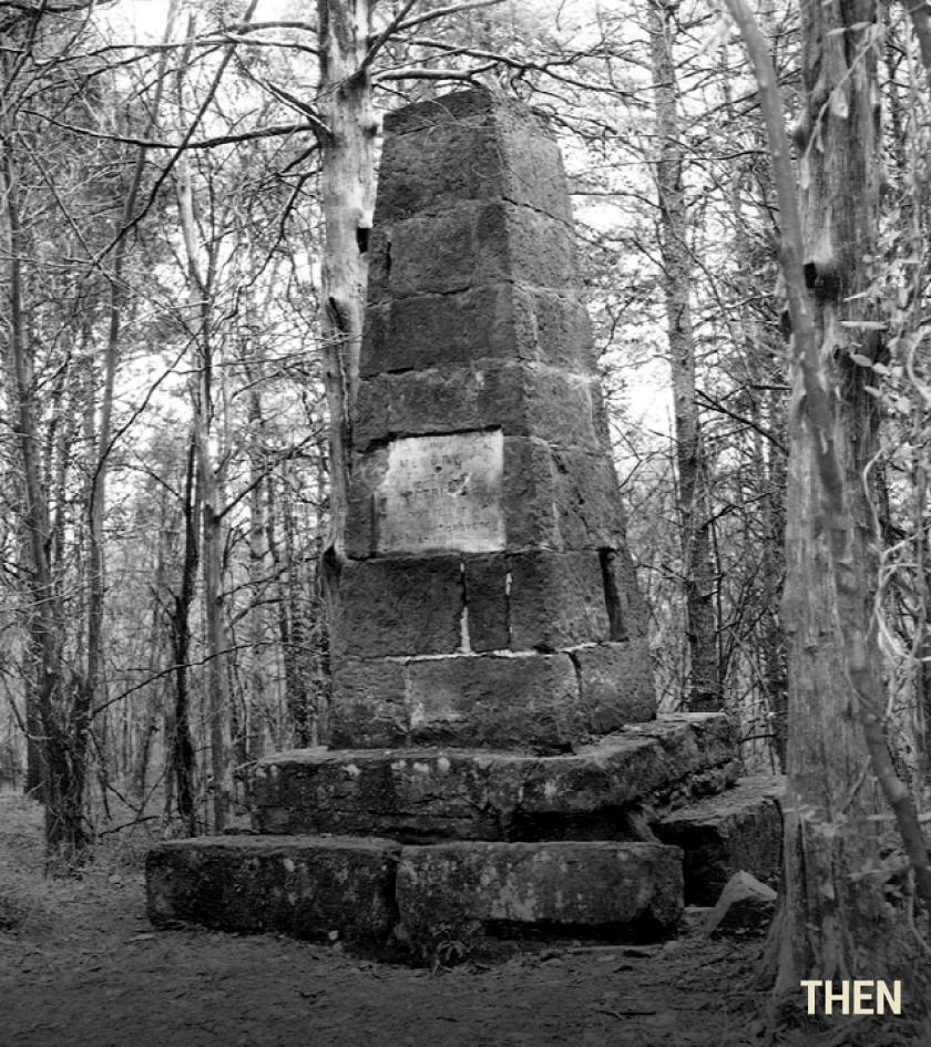
The Manassas Battlefield memorials were built quickly and could not stand the test of time without preservation and maintenance. This was especially true for the isolated and rarely visited Groveton Monument. As the small cedar trees planted around the memorial upon its completion, as well as scores of other trees, grew to maturity, the monument’s mortar crumbled, its weight shifted and its red sandstone blocks deteriorated.
Groveton, Looking North from the Warrenton Turnpike, by Albert Kern, 1908

The hamlet of Groveton sat at the intersection of the Warrenton Turnpike and the Groveton-Sudley Road. From the open fields in the left distance, Union forces attacked strongly positioned Confederates in the distant wood line. The Lucinda Dogan House, visible at left at the northwest corner of the intersection, came under the protection of the National Park Service in 1949. Since 2019, stabilization and restoration work has been underway on the adjacent M. J. Dogan House, located just out of frame to the left of the original image.
Soldier Graves below Sudley Church, Barnard, March 1862
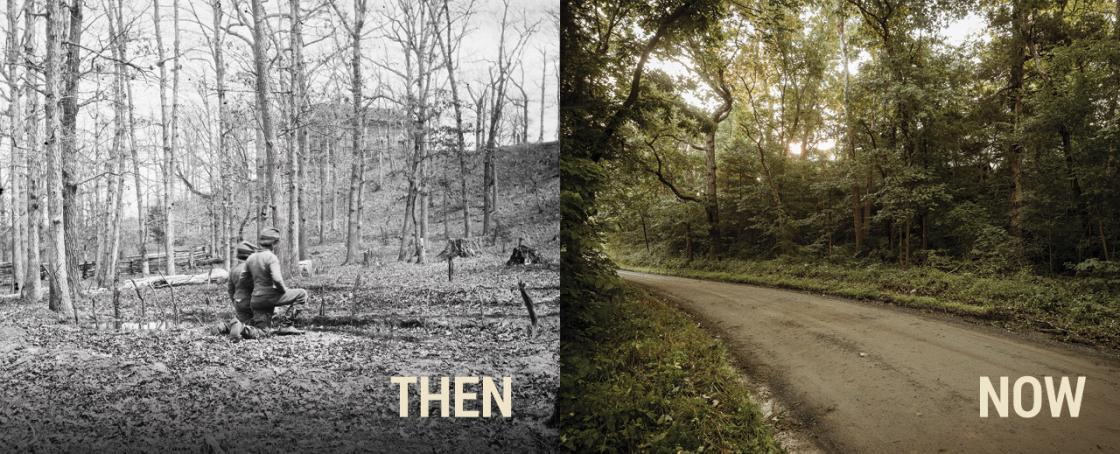
July 21, 1861, was a Sunday. Local residents dressed in their finest to attend services at Sudley Church. Soon the area was inundated with thousands of soldiers, and by early afternoon the house of worship was filled with Union dead and wounded. Dead soldiers were buried all around the church in temporary graves, including those shown here, marked with simple stakes and arrayed around the Confederate-attired boys. Barnard recorded two almost identical scenes here. The church has been rebuilt and enlarged over the years but occupies the same ground as it did during the Civil War.
Related Battles
14,462
7,387
2,896
1,982
