Battle of Gettysburg - Ditterline

Battle of Gettysburg - Ditterline
Library of Congress
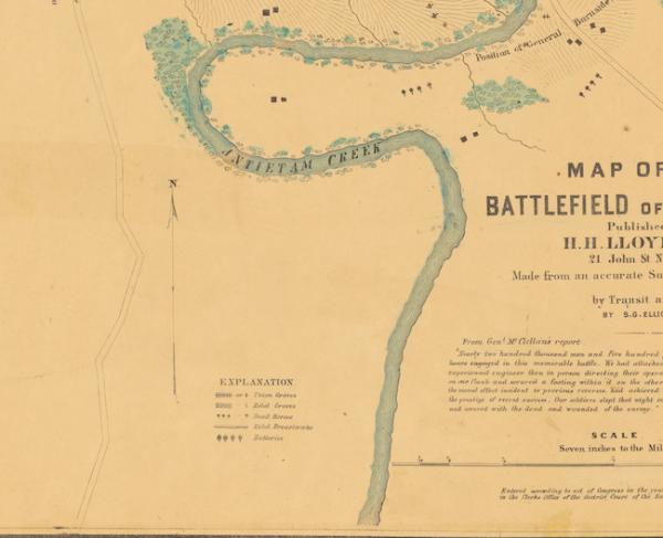
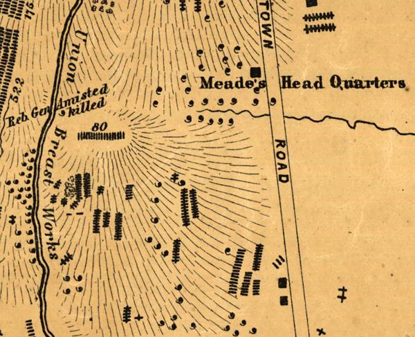
Historical map of the Battle of Gettysburg
Field of Gettysburg, July 1st, 2nd & 3rd, 1863 Prepared by T. Ditterline.
[Philada. P. S. Duval & Son lith. 1863]
Scale ca. 1:25,500,.
Reference: LC Civil War Maps (2nd ed.), 331
From his Sketch of the battles of Gettysburg . . . New York, C. A. Alvord, 1863. 24 p.
Oval-shaped map depicting troop and artillery positions, relief by hachures, drainage, roads, railroads, and houses with names of residents.
Description derived from published bibliography.
Library of Congress Geography and Map Division Washington, D.C. 20540-4650
Learn more: The Battle of Gettysburg

CalltoArms
Help Save 15 Hallowed Acres at Gettysburg
We’re nearly to the finish line to save 15 hallowed acres at Gettysburg. Please help us raise the remaining needed in time for Gettysburg’s 162nd...