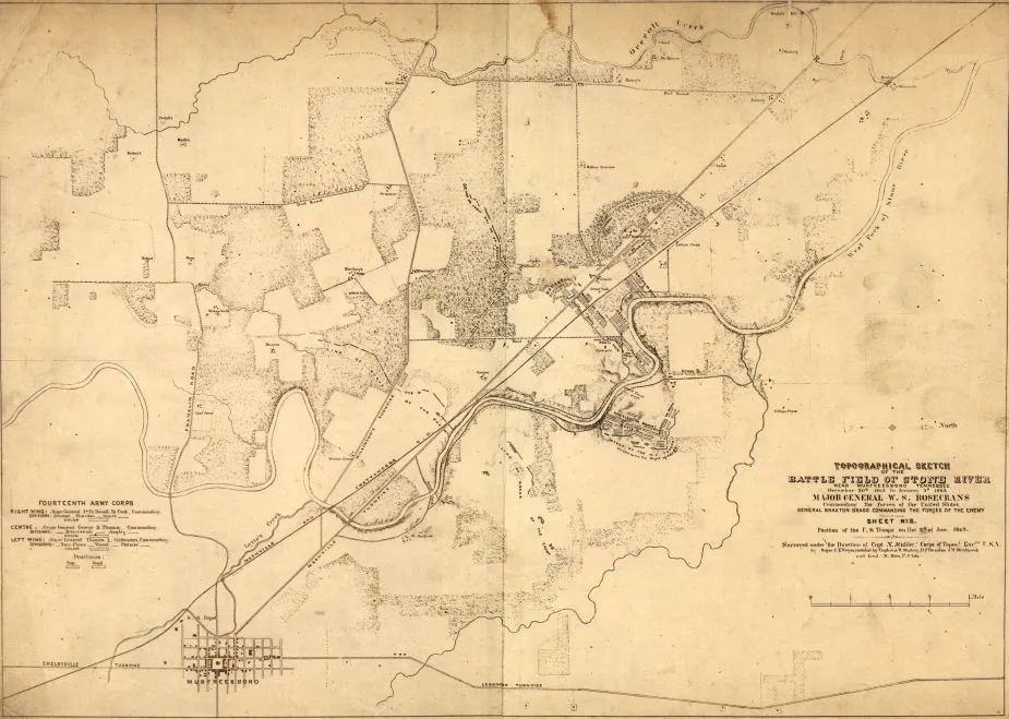
Battle of Stones River - Sketch near Murfreesburo, Tennessee December 30, 1862 - January 3, 1863
Historical map of the Battle of Stones River
Topographical sketch of the battlefield of Stone River near Murfreesboro, Tennessee, December 30th 1862 to January 3d 1863
Position of the U.S. troops on the 2d of Jan. 1863. Surveyed under the direction of Capt. N. Michler, Corps of Topogl. Engrs., U.S.A., by Major J.E. Weyss, assisted by Captains W. Starling, D.P. Thruston, J.W. Stinchcomb, and Lieut. M. Allen, U.S. Vols.
Weyss, J. E.
[S.l., 1863]
Scale [ca. 1:23,000]
Reference: LC Civil War Maps (2nd ed.), 444
"Sheet no. III."
Gives positions of the U.S. 14th Army Corps, "line of works of the enemy," roads, "Nashville and Chattanooga R.R.," houses, names of residents, drainage, and vegetation.
Photocopy (positive).
Description derived from published bibliography.
Library of Congress Geography and Map Division Washington, D.C. 20540-4650
Learn More: Battle of Stones River
Related Battles
12,906
11,739


