
Maps used by famous commanders in wartime can be things of legend. Could General George Washington have won his first victory against British Regular troops at Princeton without a critical map showing the roads that led to the isolated enemy force? Could Stonewall Jackson and his “foot cavalry” have performed with such mastery in the Shenandoah Valley without Jedediah Hotchkiss’s maps? Likely not. Military commanders crave maps as critical resources to achieve victory.
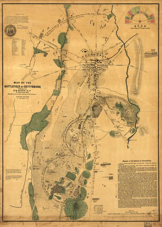
Cartographic works made after an engagement or campaign, however, are also essential resources in understanding what happened and where it happened and, by providing context, why it happened. S.G. Elliott’s 1864 Map of the Battlefield of Gettysburg is one such map.
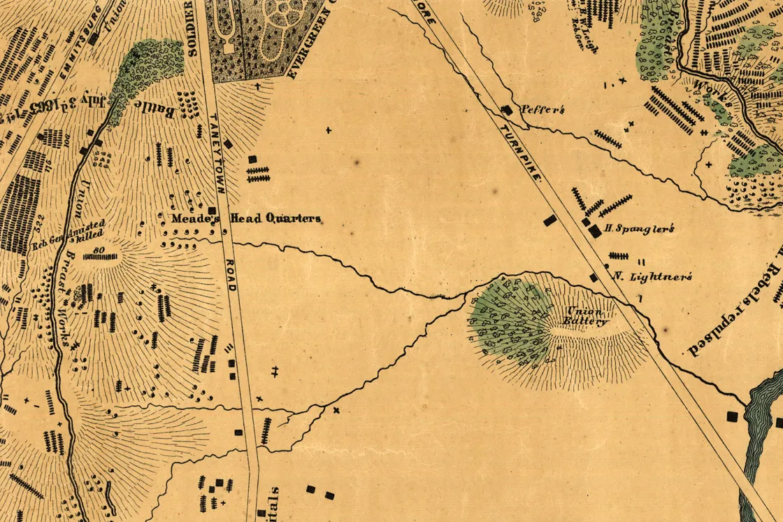
While an 1858 map of Adams County, Pa., helped commanders march to Gettysburg, and numerous postwar maps aimed to place troop positions precisely onto battlefield terrain, Elliott’s map stands out as something different. There are few contour lines and no rectangular blocks to denote military units. Elliott revealed other things — the locations of corpses, carcasses and fortifications amidst Gettysburg’s road systems and farm structures. With this unique focus, Elliott performed a great service for 19th-, and indeed, 21st-century Americans. Elliott captured battlefield carnage in a manner all his own. Photographers secured — visually, on their glass plates — tiny slices of battlefield bloodshed, while combatants captured select scenes in textual format via their letters, memoirs and other reminiscences. But no one else geolocated for all time the blood bath that was Gettysburg, as well as individual graves, artillery emplacements and breastworks. Historians know that Elliott’s work is not perfect — in many cases, far from it, but his map is an essential resource for not only historians, but also modern preservationists.

The American Battlefield Trust consults Elliott’s map as part of its due diligence for every single acre we consider acquiring at Gettysburg. Indeed, the map helps us know what properties are hallowed ground. In preserving battlefield land west of Willoughby Run, along the Baltimore Pike and Emmitsburg Road, on East Cemetery Hill, Oak Ridge and Barlow’s Knoll, Trust members felt the impact of Elliott’s work. Our members stepped up mightily for great efforts on Seminary Ridge and Lee’s Headquarters long after Elliott placed Union and Confederate graves on the parcels we were aiming to protect.
While other maps may point toward helping armies succeed in battle, Elliott’s achievements endure as one of our best resources for the preservation of America’s greatest battlefield.
We're on the verge of a moment that will define the future of battlefield preservation. With your help, we can save over 1,000 acres of critical Civil...


